INTRODUCING
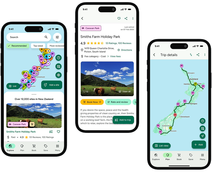
BOOKINGS ON WIKICAMPS
Mt Tuhua Track
 Point of Interest
Description
This is a steep tramp to the open tussock peak of Mt. Tuhua (1125 m) and is suitable for fit people only.
Time: approx 7 hours.
The track begins at Lake Kaniere, from the southern end of Hans Bay. The signposted entrance is on the southern side of Tuhua Creek Bridge.
This track to the open tussock peak of Mt Tuhua (1,125 m) is steep and is suitable for fit trampers only. The track is marked with orange triangles for its entire length. Check weather and track conditions before setting out.
From Hokitika head east along Lake Kaniere Road for 19 km. This road meets the lake at 'The Landing'. The road forks at this point, the right road heads to 'Sunny Bight' and the other is Dorothy Falls Road which takes you around the east side of the lake past Hans Bay.
You should take strong comfortable tramping boots, warm clothing, as well as spare clothing and a good water proof raincoat.
Remember to take plenty of water with you and high energy food.
The trip should not be attempted in bad or cloudy weather, as it will become difficult to locate the track markers on the open tussock tops; you will also miss the spectacular panorama of The Southern Alps, Lake Kaniere, Hokitika and the coastal plains.
You will require topographical Map J33 Kaniere.
For track conditions, maps, weather forecasts and more information on the area contact the local DOC office.
Find this site and more on WikiCamps
Take the ultimate camping companion on your next trip, with these great features:
![]() Explore more than 60,000 sites across New Zealand with detailed site information at your fingertips
Explore more than 60,000 sites across New Zealand with detailed site information at your fingertips
![]() Stay in the know with exclusive, insightful reviews from fellow travellers
Stay in the know with exclusive, insightful reviews from fellow travellers
![]() Map journeys, plan your route, and gauge your fuel spend with Trip Planner
Map journeys, plan your route, and gauge your fuel spend with Trip Planner
![]() No signal? No worries! Use offline mode to travel anywhere with WikiCamps
No signal? No worries! Use offline mode to travel anywhere with WikiCamps
![]() Add sites to your collections, search with intuitive filters, and so much more...
Add sites to your collections, search with intuitive filters, and so much more...
Get WikiCamps now!
Download WikiCamps from the App Store on your device.

