INTRODUCING
BOOKINGS ON WIKICAMPS
Mt Robertson
 Point of Interest
Description
Mount Robertson Track
Time: 8-9 hr return
Access onto the Mt Robertson Track is from the Loop Track (tramping track standard) and is well sign posted from two access points on the Port Underwood Road.
The Loop Track climbs through regenerating and mature forest to a junction at about 700 m altitude where the Mt Robertson Track begins. From here the track follows an obvious ridge to the summit through beech forest. This last section of the track takes about two hours. There is no water supply on the track so make sure you take water with you.
At 1036 m above sea level, Mt Robertson (Toko Maru) dominates the Scenic Reserve to which it gives its name.
For a longer trip, with the added reward of starting from sea level, begin your ascent from either Whites Bay or Rarangi using the tracks described above to get to the loop track starting points.
No dogs.
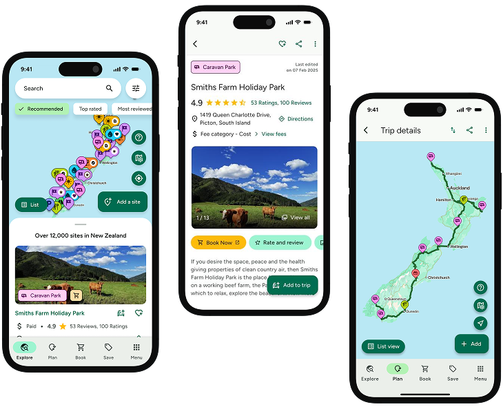
Find this site and more on WikiCamps
Take the ultimate camping companion on your next trip, with these great features:
![]() Explore more than 60,000 sites across New Zealand with detailed site information at your fingertips
Explore more than 60,000 sites across New Zealand with detailed site information at your fingertips
![]() Stay in the know with exclusive, insightful reviews from fellow travellers
Stay in the know with exclusive, insightful reviews from fellow travellers
![]() Map journeys, plan your route, and gauge your fuel spend with Trip Planner
Map journeys, plan your route, and gauge your fuel spend with Trip Planner
![]() No signal? No worries! Use offline mode to travel anywhere with WikiCamps
No signal? No worries! Use offline mode to travel anywhere with WikiCamps
![]() Add sites to your collections, search with intuitive filters, and so much more...
Add sites to your collections, search with intuitive filters, and so much more...
Get WikiCamps now!
Download WikiCamps from the App Store on your device.

