INTRODUCING
BOOKINGS ON WIKICAMPS
Bowenvale Car Park (Track End)
 Point of Interest
Description
A great walk with plenty of variety and sweeping views over the Canterbury Plains. Distance: 3.5 km. Time: One hour one way.
Start: The car park at the end of Bowenvale Avenue, Cashmere.
Finish: Bowenvale car park, Summit Road.
Enjoy this walk up Bowenvale Valley to Summit Road and then choose a variety of return options.The track starts at the end of Bowenvale Avenue as a vehicle track before becoming a walking track further up the valley, and winding its way through open tussock to Summit Road.From here, cross the road to Cedrics Track and return to Bowenvale via the Sugarloaf carpark or pick up Mitchells Track to Sign of the Kiwi before heading back to Bowenvale.
Dogs must be kept on a leash.
Freedom camping prohibited in parks and reserves.
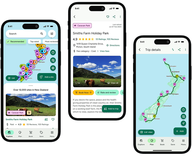
Find this site and more on WikiCamps
Take the ultimate camping companion on your next trip, with these great features:
![]() Explore more than 60,000 sites across New Zealand with detailed site information at your fingertips
Explore more than 60,000 sites across New Zealand with detailed site information at your fingertips
![]() Stay in the know with exclusive, insightful reviews from fellow travellers
Stay in the know with exclusive, insightful reviews from fellow travellers
![]() Map journeys, plan your route, and gauge your fuel spend with Trip Planner
Map journeys, plan your route, and gauge your fuel spend with Trip Planner
![]() No signal? No worries! Use offline mode to travel anywhere with WikiCamps
No signal? No worries! Use offline mode to travel anywhere with WikiCamps
![]() Add sites to your collections, search with intuitive filters, and so much more...
Add sites to your collections, search with intuitive filters, and so much more...
Get WikiCamps now!
Download WikiCamps from the App Store on your device.

